Valmiera – Caunītes


Valmiera – 4 km Gaujas bridge – 17 km Caunītes
Stage consultant – Sarmīte, WhatsApp or SMS, +371 29119121, e-mail: lacesarmite@gmail.com
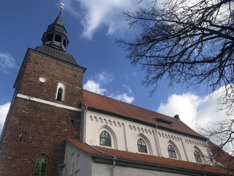
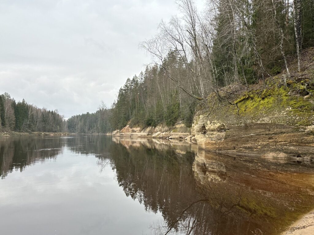
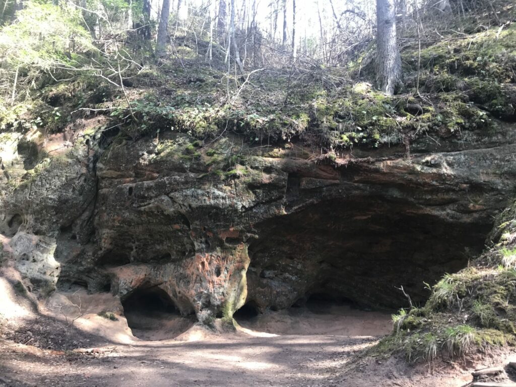
This stage of 21 km from Valmiera to Caunas starts in Valmiera from the St. Simon’s Church and leads along the Gauja river to Gauja national Park – in the direct and transmitted sense of the word in the forest, because the right bank of Gauja river between Valmiera and Cesis is sparsely populated, and most of the area is covered in forest. There are no shops and no catering places along the way, so should stock up in Valmiera with food for at least a day and a half and with drinking water for one day. There will be no bridges across the Gauja river once leave Valmiera city. However, this section of the road will not be a monotonous forest road, but along the way there will be an opportunity to see one of the most beautiful natural monuments of Latvia – Sietiniezis, the largest outcrop of white sandstone in the Baltics.
Before start the food and water can be purchased at the shopping mall “Valletta” (right opposite of the St. Simon’s Church) or in “Rimi” store (across the footbridge to the left of the road). From the St. Simon’s Church go to the left towards the viewing area. From that, to the right, a path passed along Gauja. We go straight down to Cesu Street, then turn to the left in the direction of the bridge. As soon as we cross the bridge, there is a downward staircase on the left. We go down them, turn to the left under the bridge along the path, and go straight between Gauja and the fence of company Valpro.
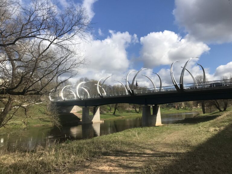
At 1.6 km, in front of the moat and stone pile, the path turns to the left, and proceeds until after 300 m we reach the pedestrian bridge over Gauja. You can step up and look at it. But the route continues along the sandy road a little to the right under the bridge and then straight.
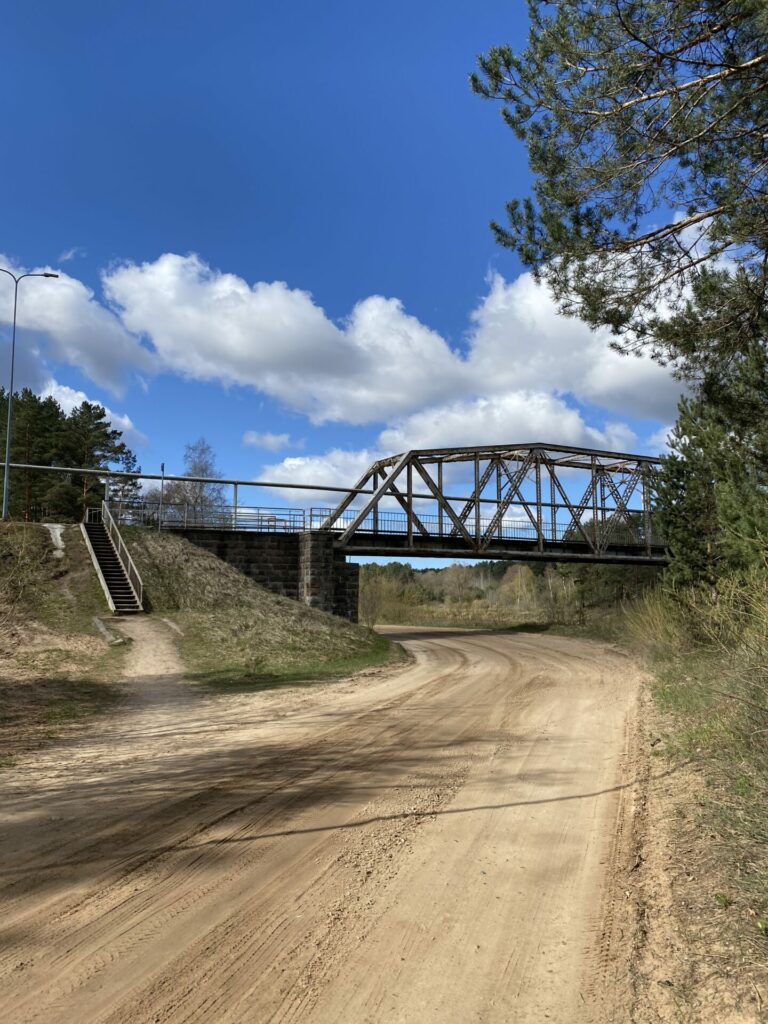
About 1.1 km later we come to the square, opposite the TV tower on the other side of the Gauja river, the side road leads to the left, but we keep our way straight and hold to the right on the next spilt road, all the time passing along Gauja. The road gradually turns into a trail. We walk down under the bridge , up the path to the left, onto the Valmiera bypass, and through the left side of the bridge we cross the bridge over the Gauja river. At this bridge is the beginning of the alternative route along the left bank of the Gauja (details below).
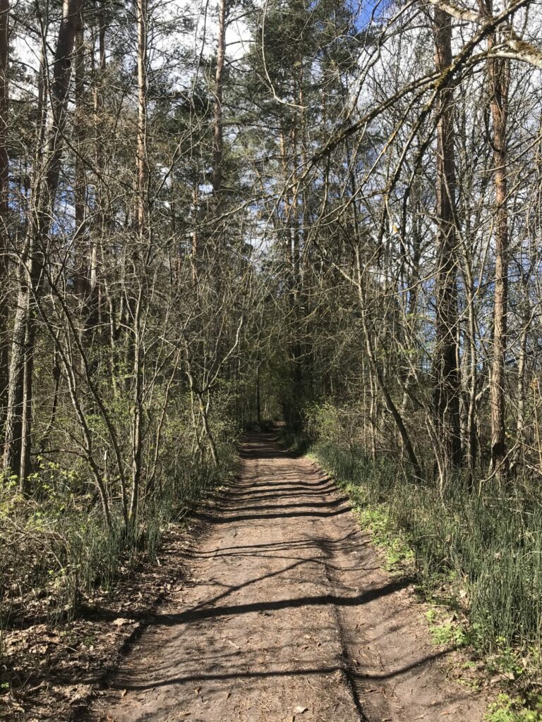
After crossing the bridge walk a little along the bypass and turn left at the first intersection with the tarmac road. We follow the tarmac road, cross a small Jumara River, continue along the tarmac road until we reach the hangars of warehouses and factories. We move on in the direction of the bus stop (the “Byko-Lat” stop) and turn to the left shortly before the stop, where a country road leads across the meadow. We follow this road, cross the gravel road 600 metres later, and continue straight towards the edge of the woods. We walk about 100 metres along the edge of the woods and then, following the popular path, turn left into the woods. With this moment, we disappear from civilization, and from now on we will meet people only at Sietiniezis, except for some randomly met cyclist or other pedestrian. Or a rare farm in woodlands.
As we enter the forest, our path initially leads down the so called The Baron trail (not marked in nature, but some maps give this trail designation) – after about 100 metres the trail turns to the left, where it stays narrower and takes us to the next intersection, where we turn to the left, where the road pointer points the way to the nature-watching trail. The second road indicator shows that up to Valmiera (we have come from this side) is 4 kilometers, but that is the distance to the outskirts of the city. We’ve gone twice as far.
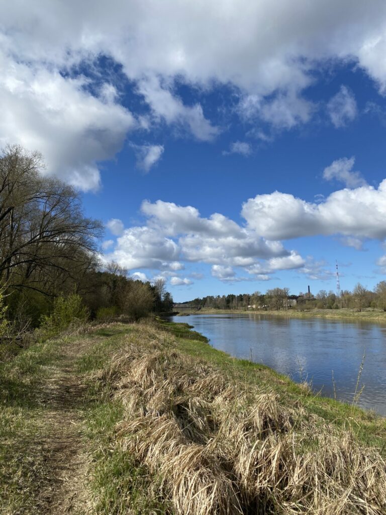
The path initially leads down, then spins to the right and leads straight ahead for a while. If you hear people’s voices in the woods, you don’t have to try to see where these sounds come from, because Gauja River, a popular boating and rafting spot on this stretch of river, flows past, so the sounds most likely come from the river. In some places on the left side of the trail, Gauja herself can be seen among the trees. Then, after a half-kilometre or so, the path turns left, then after a hundred metres or so, it leads to the next junction, where we turn left towards Sietiniezis. The trail leads along a deep gravel on the left, leads to the wooded meadow where the farm „Strautnieki” is located. We walk along the edge of the woods to the road that leads to the farm. Here we turn left and choose a path that leads to the right along the farm and takes us back into the woods. We go straight down the forest road. A short while later, we go straight at the intersection of roads, then turn right the next, then turn left another 200 metres later and head forward along a wide woodland road without turning anywhere. After a kilometre and a half, we reach another forest meadow, where the drive turns to the right, but we have to go straight ahead, where the farm is located in the next meadow. Along the edge of the forest, we continue along the yard of the farm until we reach the forest again in about 600 metres.
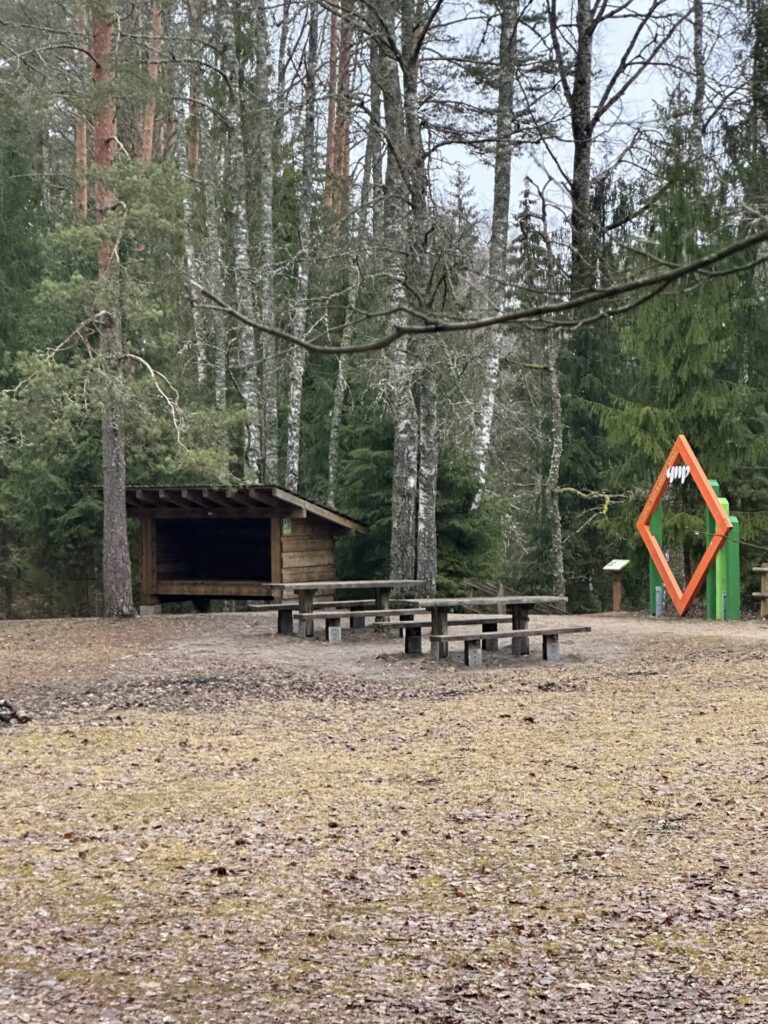
The narrow path moves a little further back into the wider woodland path. We cling to the wider trail, and within a kilometre we reach the next island in the middle of the forest, where there are several farm houses. We walk down a country road at the edge of the woods straight ahead for a kilometre and a half while the road leads back into the woods. A little farther down it bends to the right along the gravel, and soon we can see the car park behind the trees on the left and hear people’s voices. A little further away, the trail intersects with a car road leading to the Sietiniezis parking lot. We turn left and come to Sietiniezis.
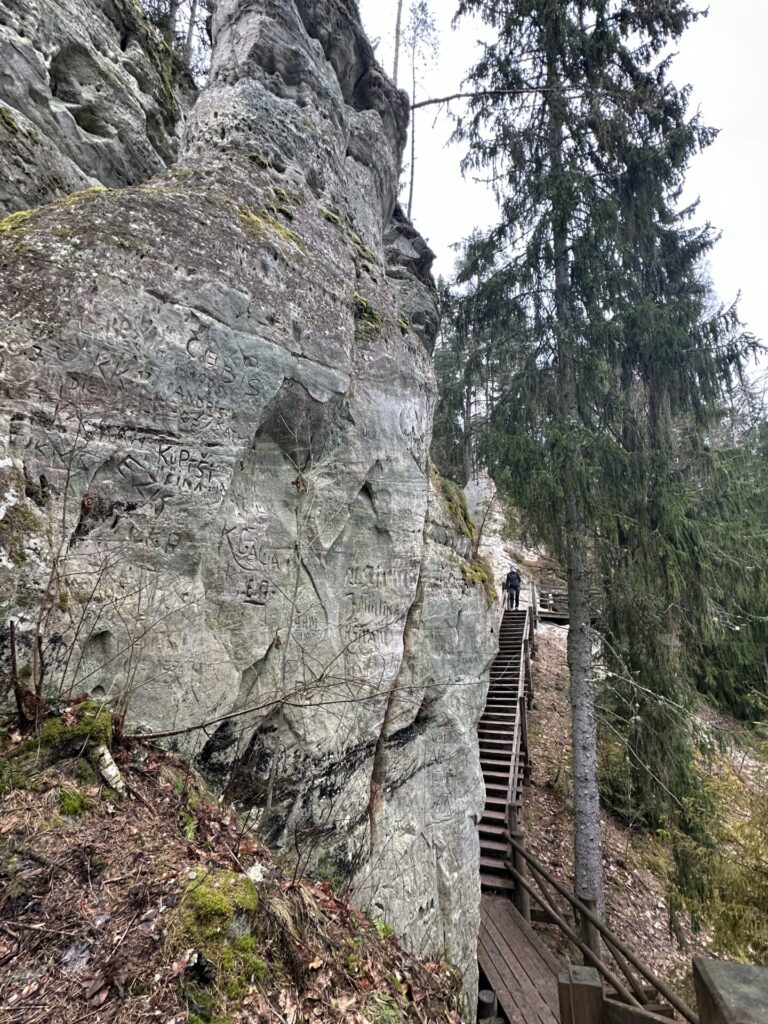
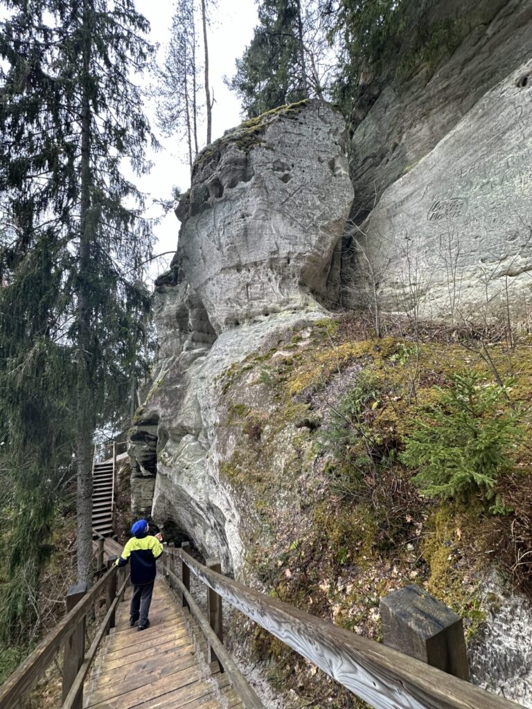
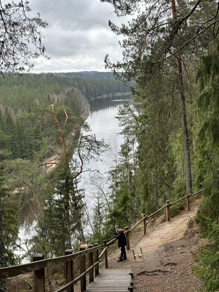
We can relax our feet at Sietiniezis, rest ourselves, visit the amenities and, of course, see the white Sietiniezis cliff. It’s also worth descending to Gauja, to enjoy beautiful view of the exposed sandstone cliffs.
As we follow the walled footpath along the white Sietiniezis cliff and draw our eyes with the beautiful views, this trail leads us up to the steep shore of Gauja, where the trail continues along the river. We go down this path.
The wide woodland trail, after just over a kilometre, leads to a slightly overgrown woodland road (marked on maps as an official way). We turn left and continue down this forest road. A short time later we reach another woodland, where there are two farms. We continue along the road along the edge of the forest (the road has already transformed into a path here in some places), enter the forest again, but a short time later we emerge into the next clearing of the forest, where we continue to walk straight along the forest until we reach the intersection where the road leads to the right, but a lesser road pass to the left. We have to follow this less-arrived road, and beyond the intersection we have to turn left, where the road along the edge of the forest leads to a farm. We soon reach the intersection of roads where cyclists roads from Cesis and Valmiera meet. Across the intersection, the road continues to the Caunites, the end of this stage.
The alternative option (left bank) – Valmiera – 10 km Līči – 8 km Grīviņi – 3 km Liepa
The stage Valmiera-Liepa-Cesis on the left coast of river Gauja partly leads through the territory of Gauja National Park, the approval of the Nature Conservation Agency is required. Consequently, the signs and road markings are installed only at agreed stages. In this section, which separates from the basic variant at the last bridge over the Gauja, the road markings are almost the entire length, except for about 800 meters.
ATTENTION!
STAGES VALMIERA – LIEPA – CESIS : FULL ROUTE DESCRIPTION AND GPX/KML TRACKS ARE NOT AVAILABLE.
In case of questions, please contact:
+371 29119121, Sarmite
+371 26358285, Aija